.png)
Hydropower is a crucial source of renewable energy, but its efficiency can be significantly impacted by the water availability. Glaciers pose unique challenges to forecasting water availability due to their dynamic nature and fluctuating meltwater contributions. HydroForecast offers a powerful solution to optimize hydropower operations in complex glacial environments.
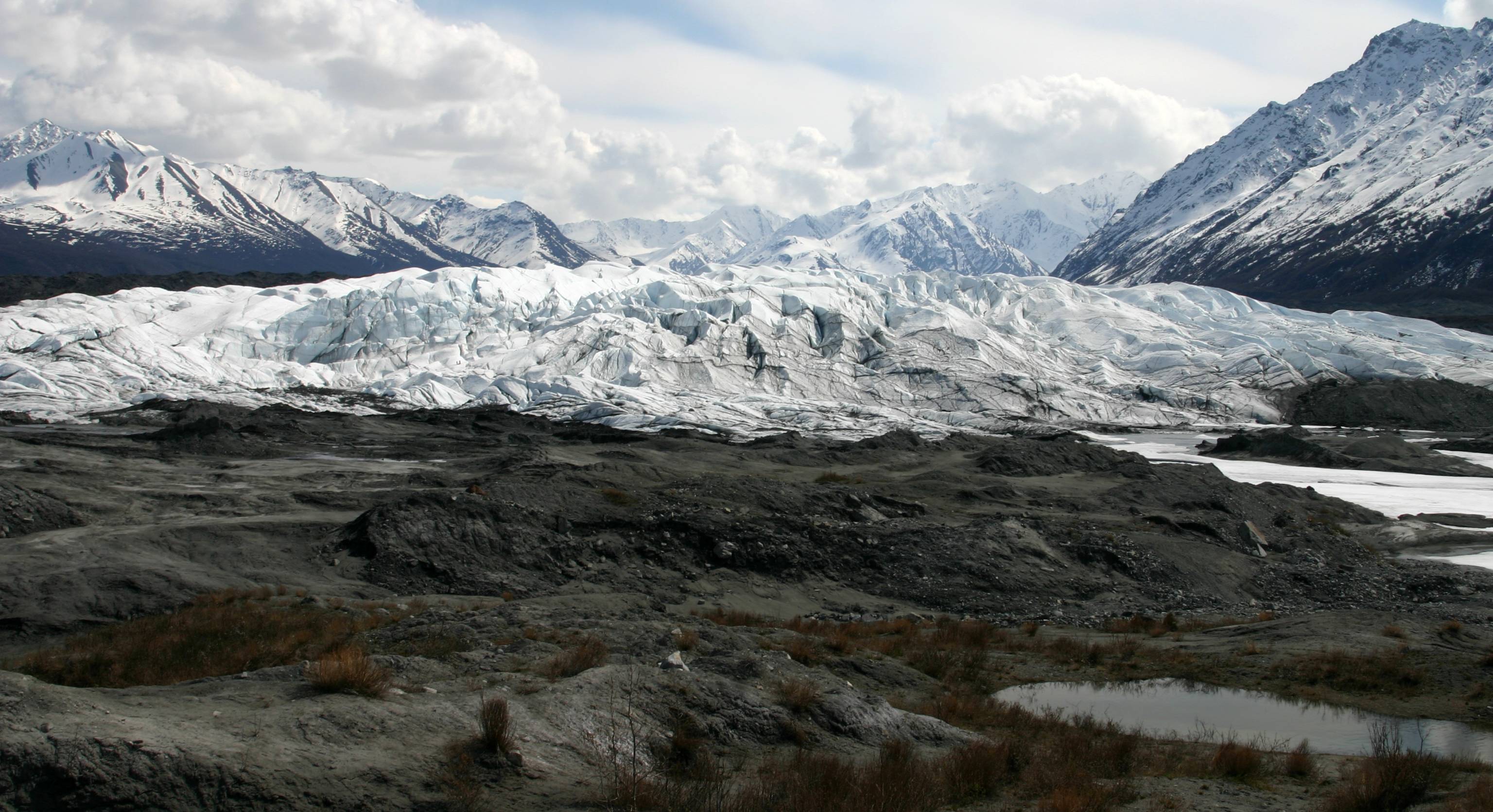
Glacier-fed river basins play an important role in global hydropower, but they also bring unique challenges for energy generation. Recent studies estimate that, around the world, there are roughly 185,000 glacierized sites contributing 13% of global hydropower. In Norway, glacier melt drives about 15% of the nation’s hydroelectric output. Given that glaciers hold roughly 69% of Earth’s freshwater, their influence on hydropower operations and planning is substantial, both now and in the face of a changing climate.
HydroForecast combines an advanced machine learning hydrologic model with weather forecasts and satellite imagery inputs to address these modeling challenges.
HydroForecast is trained on time series of satellite imagery, weather, and streamflow data and optimized to make the best prediction of total streamflow at each time step. These inputs enable the model to identify complex relationships and patterns that occur in glaciated basins, thus simplifying the solution into a single accurate model.
As glacial dynamics shift due to climate change, HydroForecast continuously learns and adapts to real-time basin conditions. For example, the model tracks the evolution of snowpack and snow cover through satellite data. As hydropower maintains a critical role in the energy mix, HydroForecast’s ability to predict melt and big changes in glacial systems is key for ensuring long-term supply.
To continuously improve our model's accuracy in glaciated regions, we trained HydroForecast on over 2,000 gauges in Canada to better learn cold-weather hydrology.
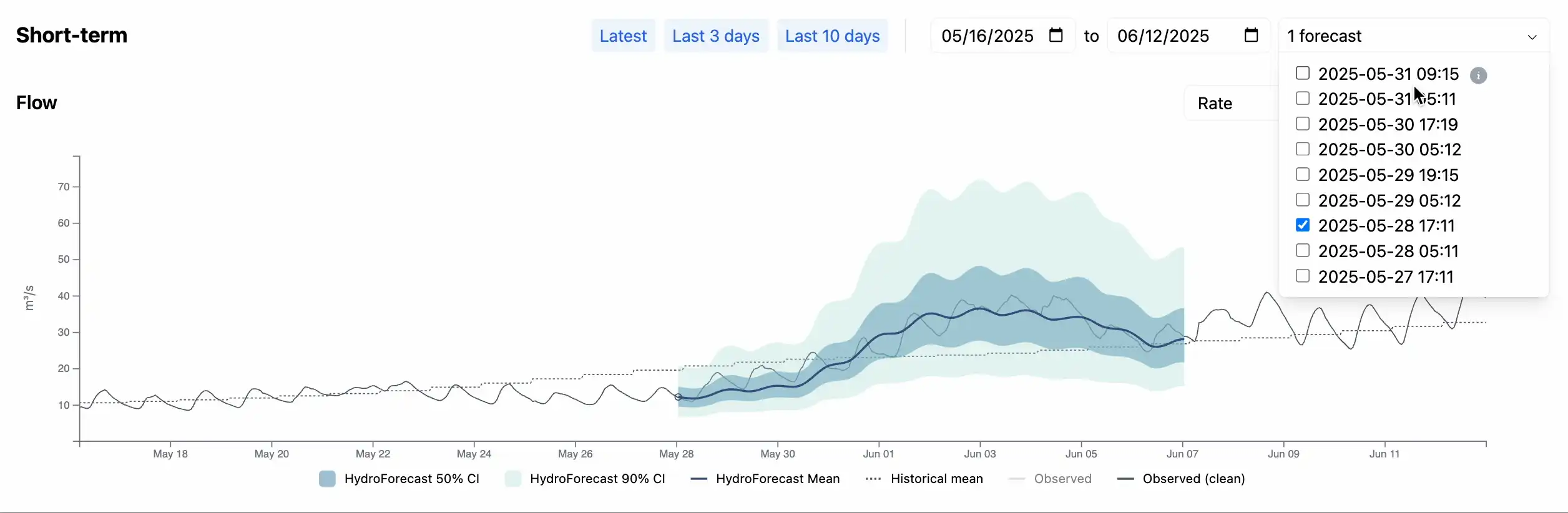
Throughout the day, hourly streamflow varies due to temperature fluctuations.
Below are examples of the HydroForecast dashboard before and after tuning the model to better capture these streamflow fluctuations due to glaciers. Prior to tuning, the model had already learned the basics of diurnal fluctuation, recognizing this pattern in snowmelt regions at large. Now, when operationalizing HydroForecast in glaciated basins, we add special parameters to handle the sensitivity of glaciers.
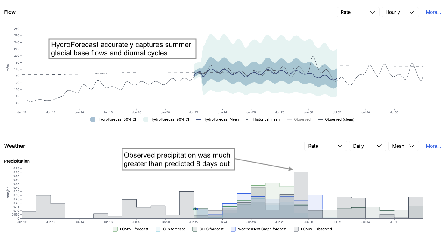
In addition to diurnal cycles, the majority of baseflow during the summer months in these regions is due to glacial melt. In the example below, the mean line accurately captures the magnitude of flow and the timing of the diurnal cycles 10-days ahead — with the added complexity of rain in the forecast.
Curious to learn how HydroForecast can work in your glaciated region? Reach out to our team to learn more.
.png)
.png)