The recent article from NASA Earth Observatory, Western Mountain Snow Melts Fast and Early, echoed a trend we’ve been hearing more often from our partners: “The melt is happening earlier than expected.” In the Western U.S., many mountain regions hit peak snowpack weeks ahead of normal, sending water downstream faster and throwing a wrench into planning efforts.
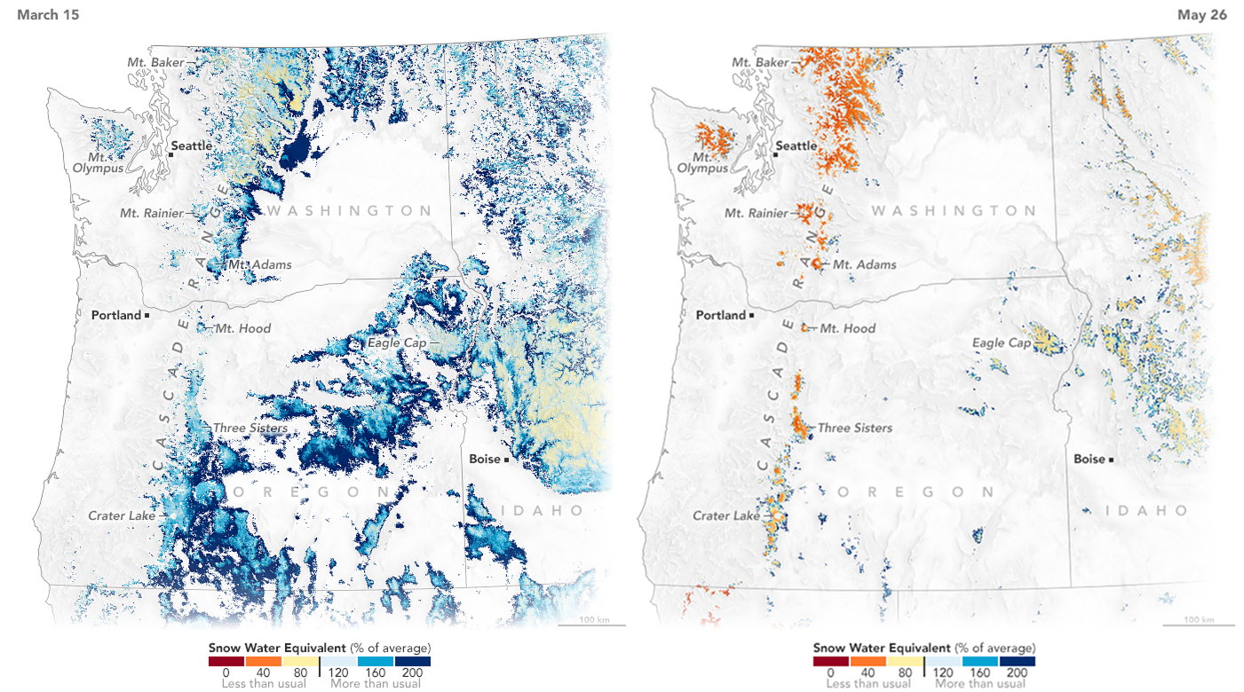
But it’s not only the Western U.S. experiencing these shifts. What once looked like an occasional anomaly is becoming a recurring pattern across the globe. Coupled with the snow drought facing much of the Pacific Northwest and Mountain West, water managers are facing unprecedented conditions.
As climate volatility grows, snowpack & snowmelt timing, storm behavior, and even the shape of the hydrograph are getting harder to anticipate. In these moments, gut feel & intuition, multi-year averages, and even well-calibrated physical models can fall short—especially when conditions no longer resemble the past.
That volatility can feel daunting, but it’s also a powerful push to rethink how we forecast and plan.
Our newest Seasonal-3 model is built to be adaptable for exactly this kind of complexity and uncertainty. By combining ensemble weather forecasts, earth observation data, and timely observations through our theory-guided machine learning model, HydroForecast helps users anticipate streamflow volumes with confidence months in advance.
Whether you’re making water supply decisions, optimizing energy markets, or planning for the next storm, HydroForecast adapts to the signals of today’s reality—not just the patterns of the past.
When the rules are changing, it pays to have a forecast that changes with them. To learn more about HydroForecast Seasonal and integrate adaptive forecasts into your workflow, please reach out to our team.
.png)
.png)