Lens makes remote monitoring easy — whether you're managing a few properties and assets or responsible for an extensive portfolio across a large geography. Combine public and commercial geospatial data with intuitive tools to track past conditions, monitor current activity, and prepare for what’s ahead.
Preview and order high-resolution commercial imagery from trusted providers — and pay only for what you need. Tap into the Lens Library for ecological indices, land cover, forest carbon layers, infrastructure overlays, and more to support baseline assessments and ongoing monitoring. Access the full library of publicly available data sources like Landsat-8 and Sentinel-2 on demand, no processing.
.jpg)
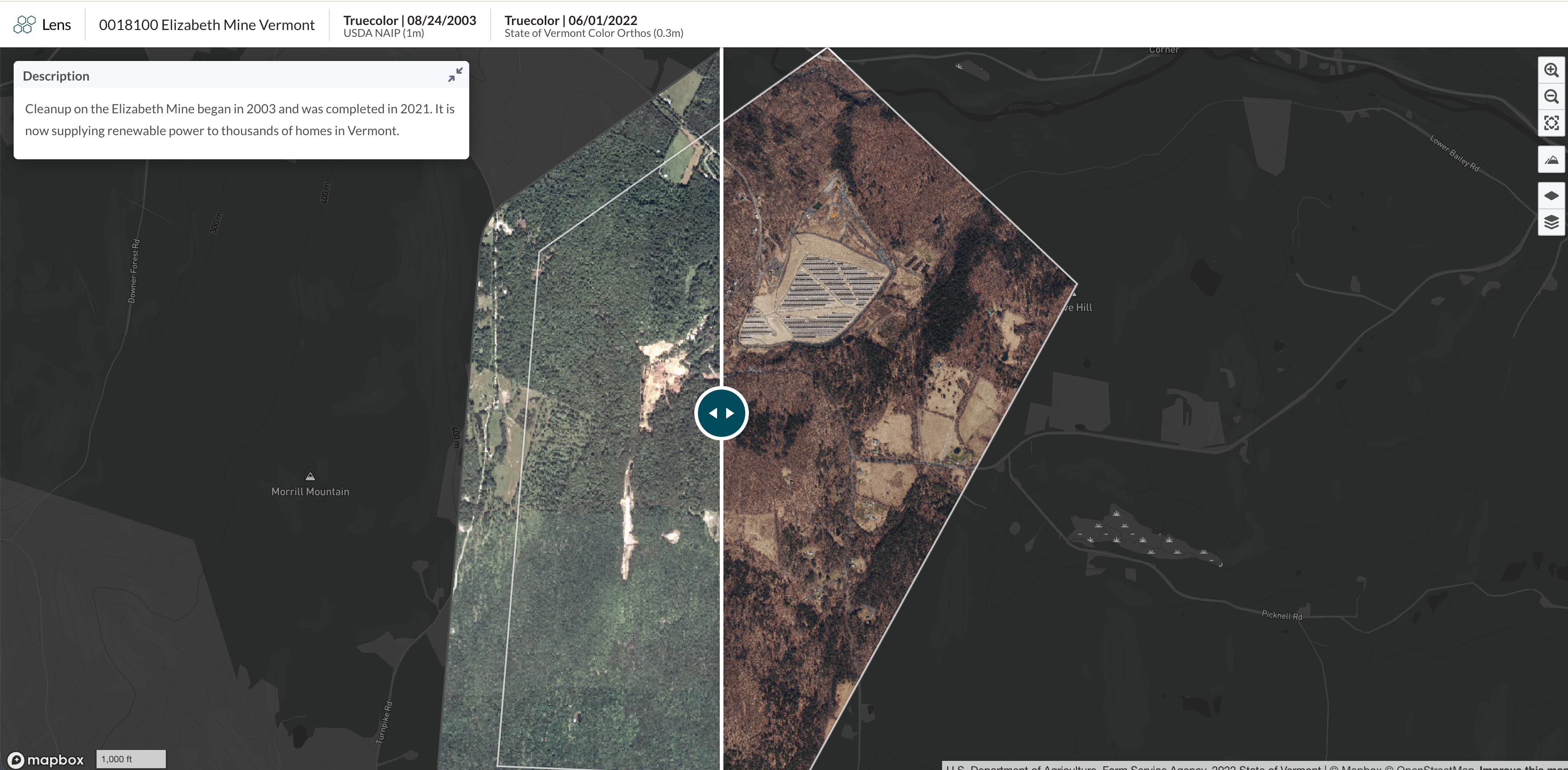
Compare current and past imagery to detect unexpected changes. Use time‑series views and analytics tools to track dynamics like wildfire recovery, flooding, forest regrowth, or land‑use change.
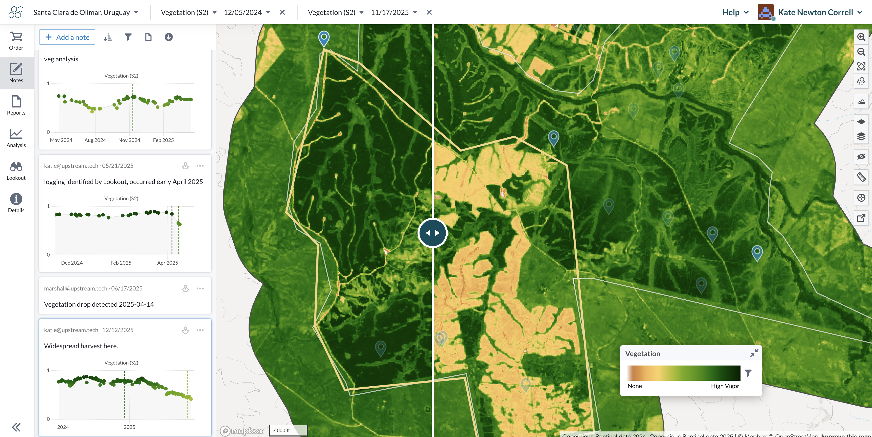
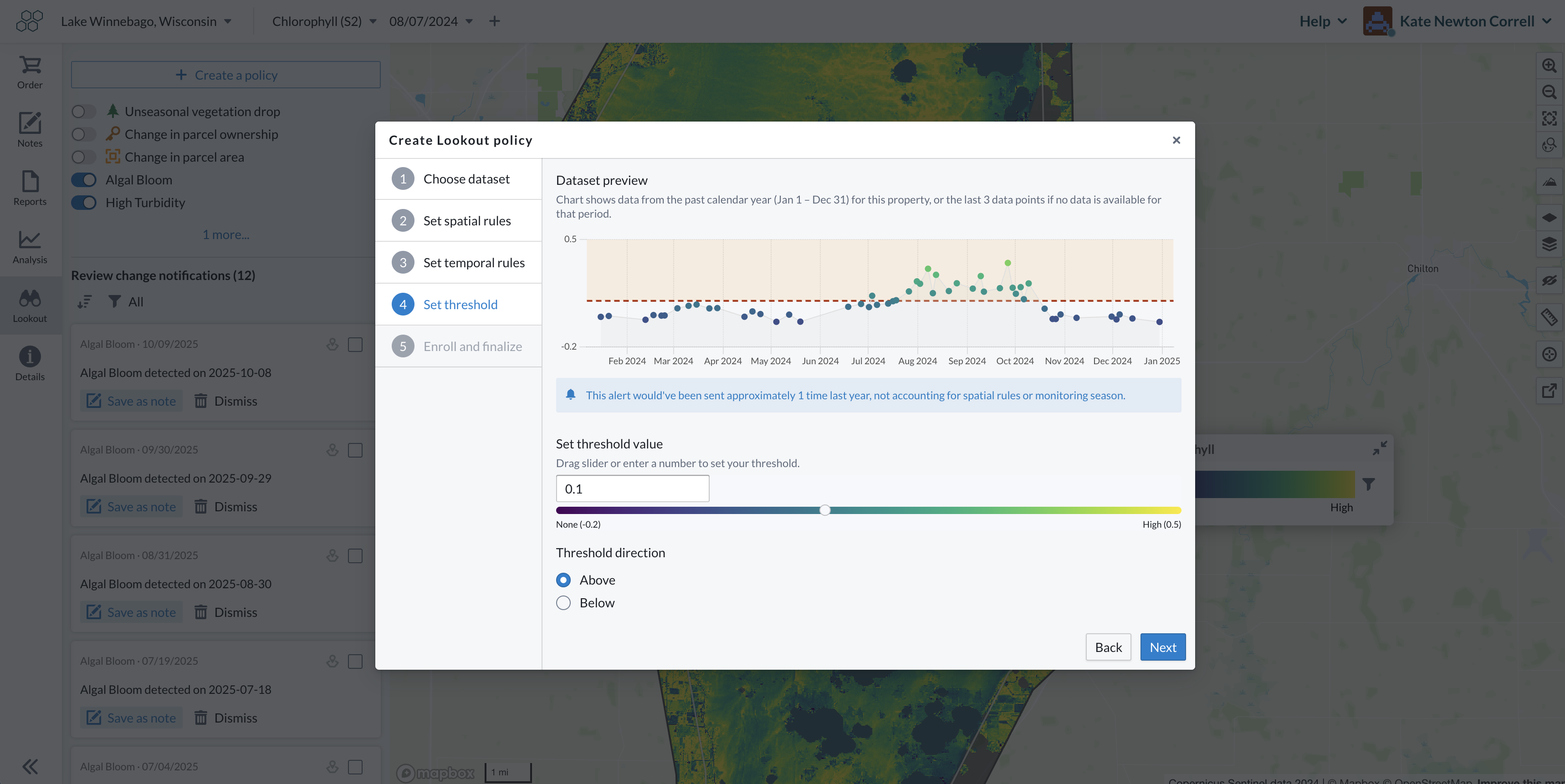
Create tailed, automated alerts with Lens Lookouts to track meaningful change across your areas of interest — from vegetation loss to flooding to parcel ownership updates. Use customization tools to ensure alerts focus on what matters in your geography, and trust that Lens is keeping an eye out on your behalf.
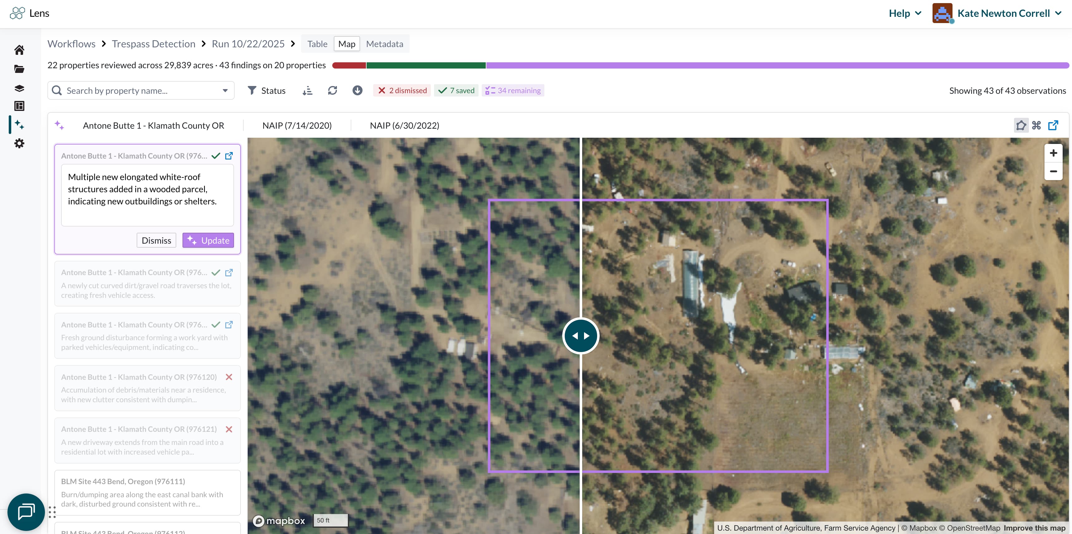
Streamline your monitoring with powerful AI tools. Our Lens agent does your monitoring work for you, highlighting the most important changes across your portfolio — like trespass or unexpected disturbance — and makes reviewing changes faster than ever. We configure Lens to your organization’s monitoring needs, helping you scale your capacity without sacrificing oversight.
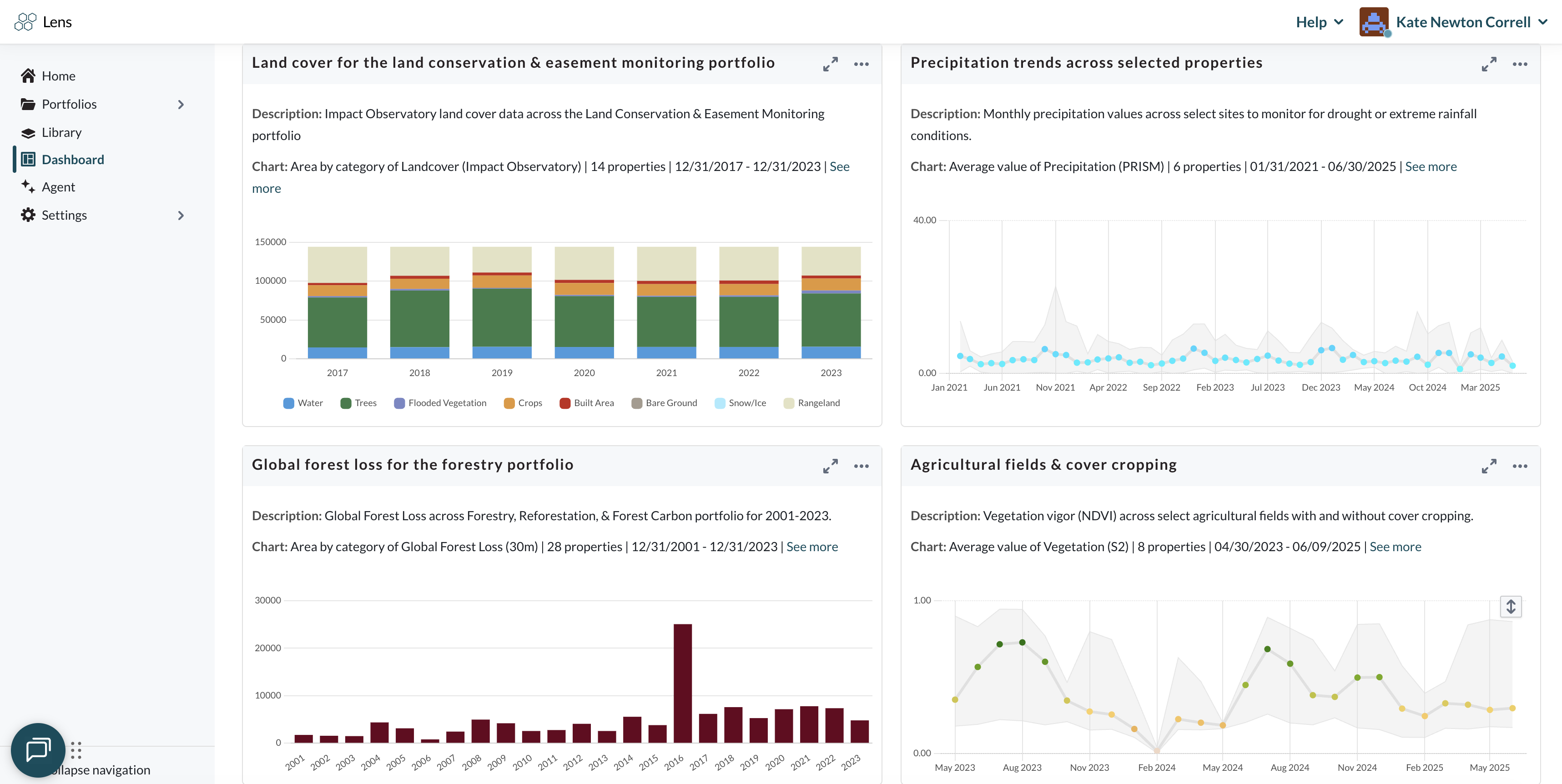
With the Lens Dashboard, you can monitor and report across dozens or hundreds of properties at once. Build custom charts, filter and sort properties, identify outliers, and share results with partners. Ideal for dynamic baselining, restoration tracking, impact reporting or monitoring change across your entire portfolio.
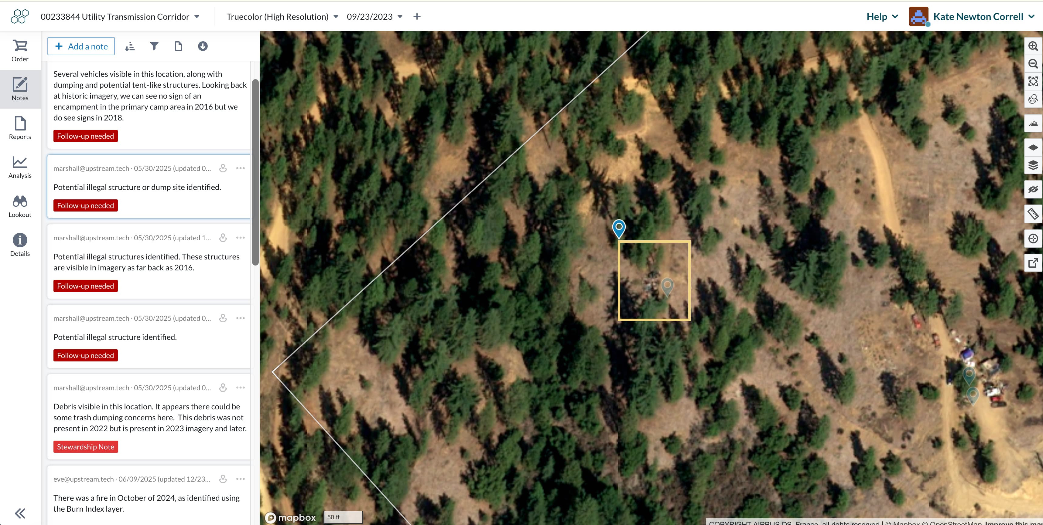
Document observations, add notes, and review past comments from colleagues. Compile imagery, charts, and annotations into clear, customizable reports for stakeholders, regulators, partners, or funders.
Easily share reports, notes, property views, or multi-property charts with collaborators — no log in required. Whether it's a field team, funder, or partner, they’ll see exactly what you want to share, with full context, current imagery, and annotations.
Lens grows with your organization. Whether you're managing 10 or 10,000 properties, you can upload data, organize properties, invite teammates tag notes, and set org-wide defaults. Team management and security features like MFA and user controls keep collaboration smooth and data protected.
.png)
Need an extra set of hands? Our team offers optional monitoring services to complement your Lens workflows — from setup to reviewing changes and ongoing monitoring. We’ll work closely with you to surface key insights, so you can spend less time reviewing, and more time acting.