For local governments, maintaining accurate property records can be a balancing act between time in the field, limited staff, and the high cost of data acquisition. County assessors in particular face the challenge of verifying thousands of parcels across broad geographies, often relying on outdated aerial imagery or investing in costly flyovers. The result: gaps in visibility, missed updates, and extra trips that stretch team time and resources.
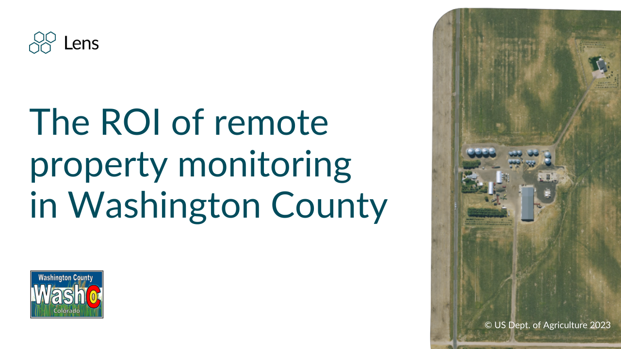
In Washington County, Colorado, County Assessor Hali Thompson has experienced these challenges firsthand. Covering roughly 2,500 square miles and 7,200 parcels, Thompson’s team is responsible for discovering, classifying, and valuing every property as of January 1st each year.
Washington County began using Lens for remote monitoring in the spring of 2025. What started as a trial to explore whether satellite data could serve their rural region has turned into a daily part of the assessment workflow. We were able to sit down with Hali Thompson to get the full scoop and understand the impact after just one season of assessment with Lens.
For many tax assessors, the hardest part of keeping property data accurate isn’t the valuation itself, it’s simply seeing what’s on the ground, when it changed, and whether it matches what’s on the tax roll. In rural counties like Washington County, where imagery on tools like Google may only refresh every five or six years, getting up to date remote information can be challenging and expensive.
Before adopting Lens, Washington County’s Assessor, Hali Thompson, relied on building permits, word of mouth, and time‑intensive field visits to verify new construction or changes across thousands of parcels. A past quote for aerial flyover imagery in the county was over $400,000—an amount that simply wasn’t feasible for a small, resource‑constrained office. That meant every suspected change often required an in‑person trip, sometimes 45 miles each way, just to confirm that a building existed.
“I was wary at first about whether satellite imagery would even work for our rural county. I honestly didn’t think the images would update out here—but to my surprise, there’s something new being added almost every day.”
- Hali Thompson, County Assessor
In the past year, Thompson has used Lens to add 23 new buildings to the County’s records, accounting for over $3 million in new assessed property value. That equates to roughly $55,000 in direct revenue gain for the county, while saving over 180 hours of field time and countless miles in travel. She’s even found new buildings just by chance in Lens, ones without a permit that might not have been caught otherwise.
“Having the most up‑to‑date information is crucial. Yes, there are building permits, but we have to value what sits there as of January 1. Bringing that value in is important to our taxing authorities—and it translates directly to more revenue.”
- Hali Thompson, County Assessor
Beyond the direct revenue impact, remote monitoring with Lens delivers additional benefits for Washington County:
For Washington County, Lens has become a core part of the property assessment workflow rather than a one‑off experiment. Before stepping into the field, County Assessor Hali Thompson now opens Lens to review current imagery for any property tied to a new building permit or recent sale, using it as a first pass to understand what has changed and what truly needs an in‑person visit.
Here are several key Lens capabilities that make this possible:
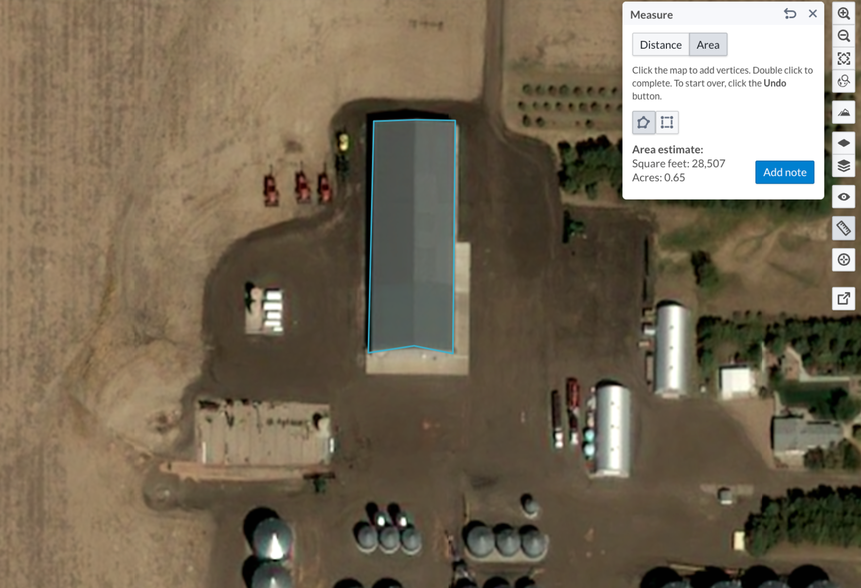
With Lens, Thompson can see up-to-date aerial imagery that is often just months old, compare it against their existing 2019 GIS data, and use the measurement tool to estimate building size and footprint from her desktop. Instead of treating site visits as the default, Washington County uses Lens to document what they see, prioritizing only the properties that truly need boots on the ground.
By pairing frequently updated satellite imagery with an easy, desk‑based workflow, Washington County has shown how to uncover new revenue, reduce field time, and work more safely with remote monitoring.
For other local governments, this same pattern—check Lens first, then decide whether a visit is needed—can unlock similar gains. Whether a team is validating permits, tracking agricultural use, or reviewing additions ahead of a reappraisal cycle, Lens offers an easy way to visualize historical and current conditions, record notes, and standardize documentation so that decisions are fast, defensible, and grounded in shared imagery rather than scattered site photos.
Ready to get started? Get in touch to learn more and see how Lens can fit into your workflow.
.png)

