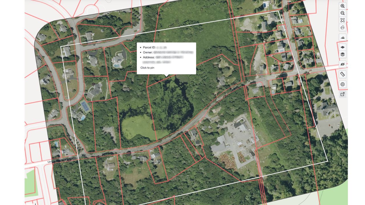
Parcel boundaries are more than lines on a map—they define ownership, legal responsibilities, and conservation priorities. But even when ownership stays the same, boundaries can still shift. Maybe it’s a new survey, a subdivision, or a quiet GIS update. These changes can affect how land is managed and impact stewardship plans.
We partner with Regrid, a leading provider of nationwide parcel data, to deliver reliable data directly in Lens, giving users quick access to up-to-date parcel boundaries and ownership information. And now, in addition to alerts on ownership status, Lens alerts you when a parcel’s area changes with our latest Lookout option, so you can stay ahead of any surprises.
This collaboration makes it possible to detect when parcel boundaries shift, receive timely alerts, and act on critical land changes with confidence.
“We teamed up with Regrid to make sure our users have the most up-to-date parcel data possible. Now, with area change alerts in Lens, you can catch subtle shifts or subdivisions before they turn into real problems.”
- Abby Smith, Director of Product at Upstream Tech
Parcel boundaries can shift for a bunch of reasons such as
It depends. Boundary changes are more common in fast-growing areas or places with regular GIS updates. In rural or conserved landscapes, they’re rarer—but not unheard of. Some counties update weekly; others might go years. And data providers like Regrid or ATTOM usually refresh boundaries at least once a year.
Bottom line: it doesn’t happen constantly, but when it does, it can matter.
For Standard and Enterprise Lens users, you’ll see a new alert option in the Lookout pane. If you enroll a property in the new Parcel Area Change policy, Lens checks the recorded area of monitored parcels using Regrid data on a quarterly basis. If the boundary has changed—even slightly—you’ll get an alert. The alert is off by default, so you can toggle it on when it’s relevant to your work.
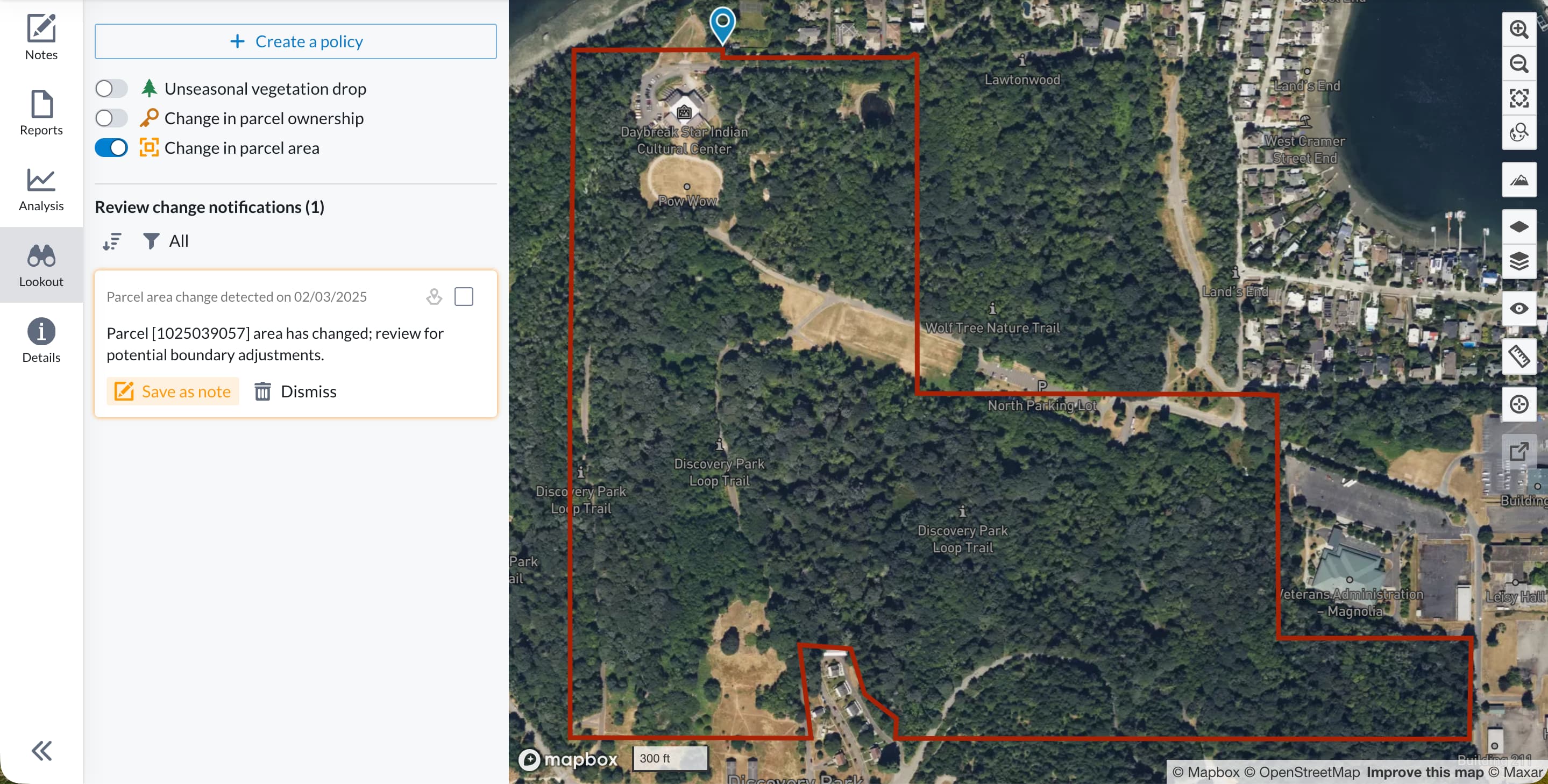
You can use this new Lookout type to:
Reach out to us if you have any questions.


.png)
