Forests are powerful allies in the fight against climate change. But tracking their carbon storage across vast, remote areas is tough. Remote sensing changes that, letting us estimate forest carbon from space at scale.
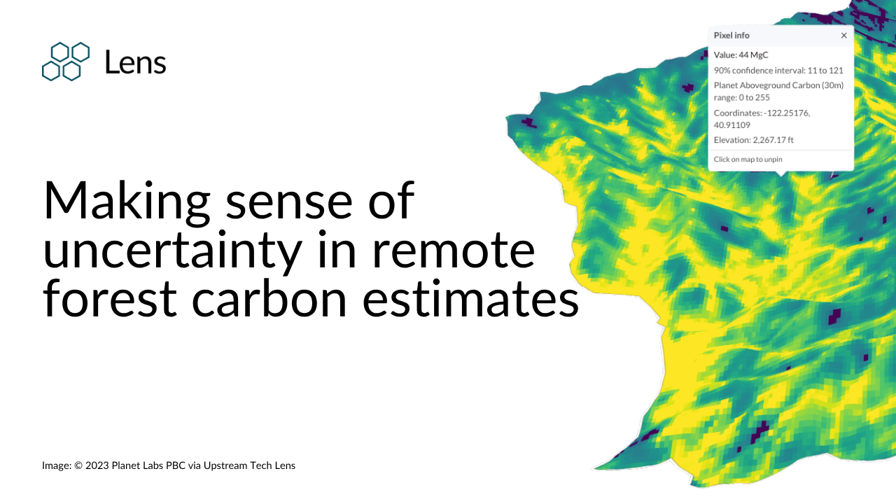
At Upstream Tech, we built Lens to put this data directly into the hands of organizations protecting and stewarding land. A key part of that data, one that's often overlooked but crucial for making sound decisions, is uncertainty.
Lens integrates forest carbon data from providers like Planet and Chloris Geospatial. They use satellite imagery and advanced models to estimate carbon. Alongside each estimate, Lens provides pixel-level uncertainty data, which you can view and download.
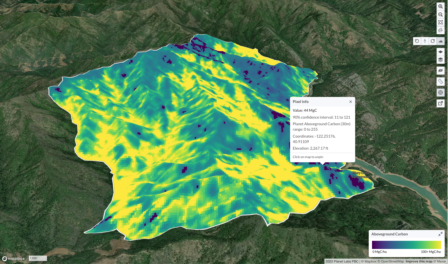
When we talk about "uncertainty," we're referring to the range of possible values around a given estimate, often shown as a confidence interval. This is because estimating complex forest structures from space has inherent challenges, including variations in forest types, sensor limitations, cloud cover, and the underlying models used. In Lens, this is specifically presented as a 90% confidence interval. This means that if you were to repeat the measurement many times, you could expect the true carbon value to fall within that reported range 90% of the time. This helps you understand the reliability of the data and make more informed decisions.
Rather than viewing uncertainty as a limitation, we see it as a fundamental aspect of scientific integrity in remote sensing. It's the data's way of being honest about its precision, and that honesty is crucial for trust and credibility in carbon accounting.
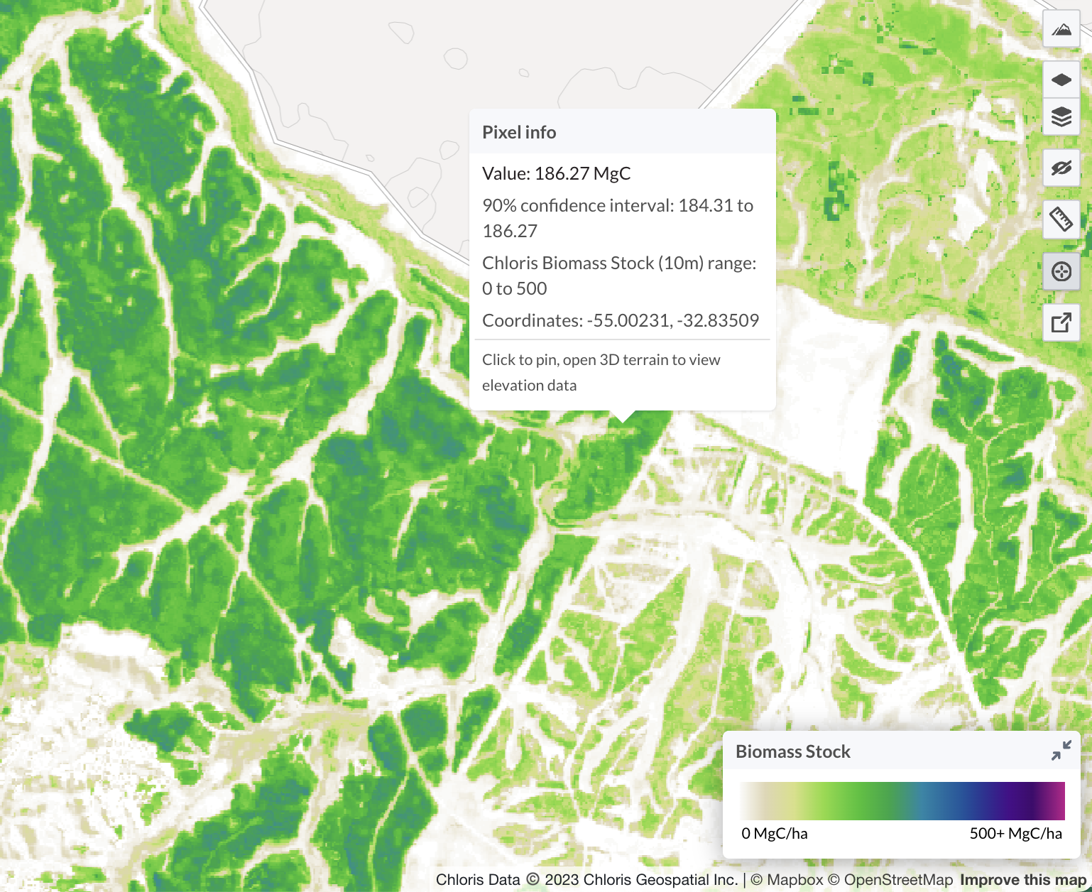
The precision of remote forest carbon estimates often presents a fascinating "scale paradox": For individual parcels or very small properties, the inherent uncertainty of pixel-level remote sensing data can be significant. This is precisely where targeted ground-truthing becomes invaluable to validate biomass carbon estimates. Conversely, when aggregating data over vast forests or large regions, these individual pixel-level uncertainties tend to average out. This means that while any single point might have a wide range, the overall estimate for a large area becomes significantly more stable and reliable.
The power of remote sensing lies in its scale. This characteristic doesn't diminish the value of remote sensing; rather, it underscores its unique and indispensable role. Remote approaches are unparalleled for efficiently monitoring carbon across vast, often inaccessible landscapes—offering a cost-effective way to track changes that would be impossible or prohibitively expensive with ground methods alone.
Here's how practitioners can leverage uncertainty data in Lens to enhance their projects and decision-making:
Ultimately, we include uncertainty in Lens because making truly robust decisions depends on it. As our remote sensing tools get more powerful, so does our responsibility to interpret them well. Think of confidence intervals not as a flaw, but as a built-in guide. They're there to help you weigh options, grasp limitations, and ultimately make more impactful and trustworthy choices for your forest carbon projects. This kind of transparency is becoming non-negotiable as carbon markets and MRV standards mature. And while new AI and machine learning will keep improving our estimates, knowing how to interpret uncertainty will always be a critical skill.
If you're working on nature-based carbon projects or curious about remote biomass estimates, see how Lens can help you navigate uncertainty and efficiently monitor your impact. Sign up for a demo of Lens to learn more today or get in touch with our team.