Have you ever looked up at the sky and thought: how the heck do the images and data collected by satellites make it back to Earth—and into tools like Lens?
In short: satellites capture what’s happening from space, then deliver that data through a chain of antenna, hardware and handoffs that ends with you. Let’s break it down.
Let’s say a satellite snaps an image of a wildlife management area in east Texas. How does that image end up in Lens, ready for monitoring?
Maybe it’s in a sun-synchronous orbit—one that sweeps from pole to pole, passing over the same areas at consistent local times. This type of orbit is ideal for monitoring change over time because the lighting conditions stay roughly the same.
As it orbits, the satellite collects data with onboard sensors: visible imagery, infrared signals, and more depending on its mission. Some satellites are operated by public agencies, others by commercial providers, but they all have one thing in common: they need to get that data down to Earth.
Public satellites like ESA’s Sentinel-2 typically follow fixed orbits and pre-scheduled capture plans, systematically imaging the globe. Commercial satellites, on the other hand, can often be tasked to capture a specific place at a specific time. That flexibility comes with behind-the-scenes coordination. Providers may pay for priority access to ground stations, high-bandwidth downlinks, and dedicated antenna time to speed data from orbit to your screen. Many commercial constellations even deploy fleets of satellites with the same sensors to increase revisit frequency and responsiveness.
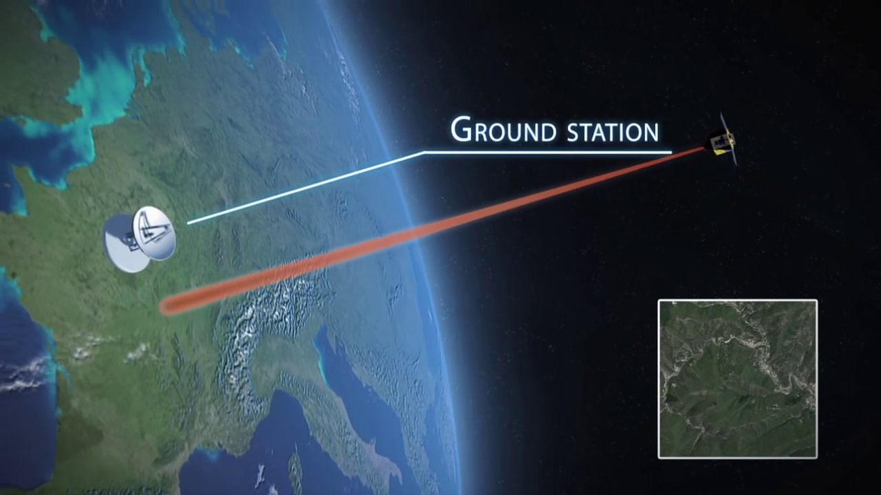
Every so often, the satellite passes over a ground station—a facility with large antennas that maintain contact with satellites when they pass overhead. These stations are often located at high latitudes to maximize the number of satellite passes they can “see.” When the satellite and ground station align, and there’s clear line-of-sight, a downlink happens. Data beams down from the satellite to Earth like a very fast and focused game of catch.
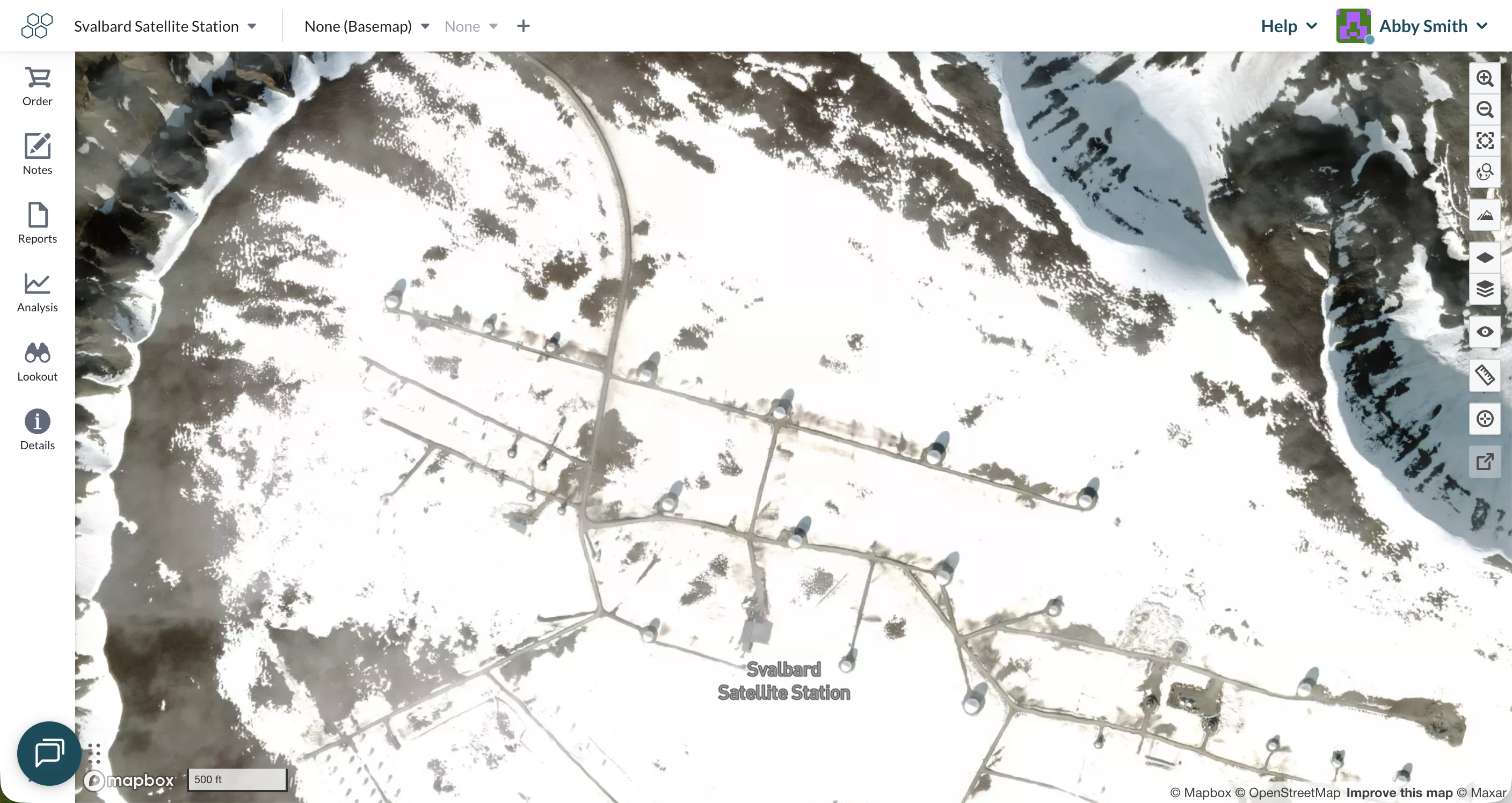
One example is the Svalbard Ground Station in Norway shown below. SvalSat is perched near the Arctic Circle and surrounded by mountains and fjords—and is home to more than 150 antennas enclosed in protective domes called radomes. These give the station its golf-ball-like appearance. Thanks to its location, Svalbard is one of the very few places on Earth where polar-orbiting satellites can downlink data on every pass. Agencies like NASA, USGS, and NOAA all rely on this station to receive critical earth observation and weather data.
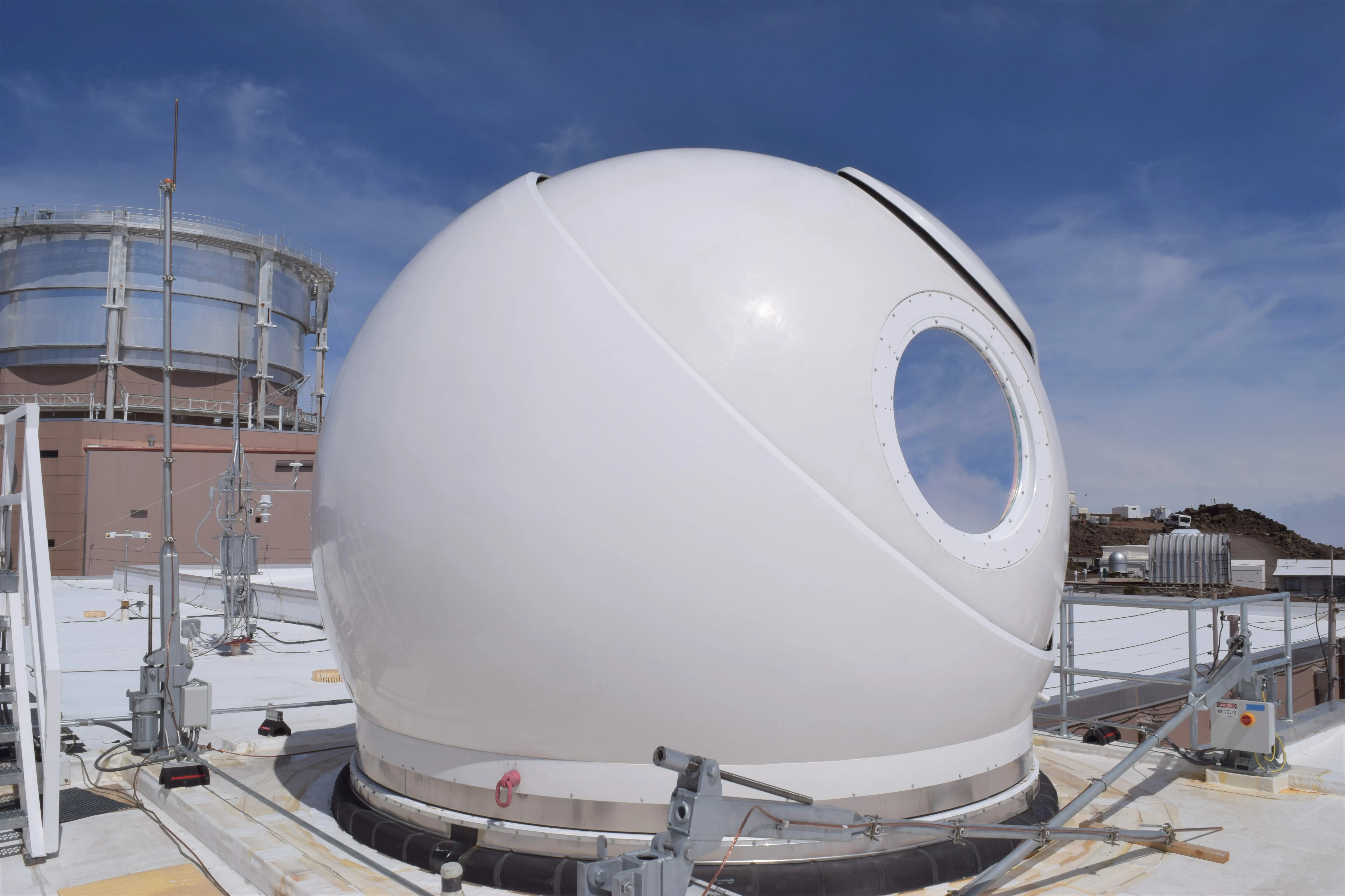
On closer inspection, you can see spherical structures called radomes—protective shells that house sensitive satellite-tracking antennas. They shield the equipment from wind, snow, and rain while letting signals pass through with less distortion. The round shape allows the antenna inside to rotate freely and maintain contact with satellites as they move across the sky.
Once the ground station receives the data, it’s typically forwarded—often via high-speed fiber-optic cable—to processing centers where the raw data is transformed into usable imagery. This involves calibration, correction, orthorectification, geolocation, and formatting to make it analysis-ready.
All that earth observation data—collected hundreds of miles above Earth, beamed down through Arctic antennas, processed and packaged by different organizations—lands in Lens. So when you’re browsing imagery of your site, you’re seeing the final step in a complex, multi-stage journey from space.
It’s tempting to imagine satellites as magical space cameras, beaming perfect images directly to your desktop. But without a network of ground stations, processing infrastructure, and smart logistics, they’d be little more than expensive metal orbiting in silence.
This is where Lens comes in:
In short: we take care of the “how did it get here?” part so you can focus on the “what’s happening on the ground?”—with affordable access to imagery from many providers, all in one place. Next time you open Lens, take a moment to appreciate the journey: from orbiting sensor, to ground station antenna, to fiber-optic cable, to data processing pipeline, and finally, to you.
Ready to see how accessible satellite imagery can level up your monitoring? Get in touch with our team to get started in Lens.
.png)
%20(1).png)
.png)
.png)