Satellite imagery can reveal a lot—changes in land use, flooding, forest conditions, and more. But every so often, it captures something unexpected: visuals that look distorted, ghostly, or just plain weird. With Halloween around the corner, it’s a fitting time to explore some of the spookier things you might stumble across in satellite imagery. Some of these are visual artifacts with technical explanations. Others are real places that just happen to look eerie from above. 👻
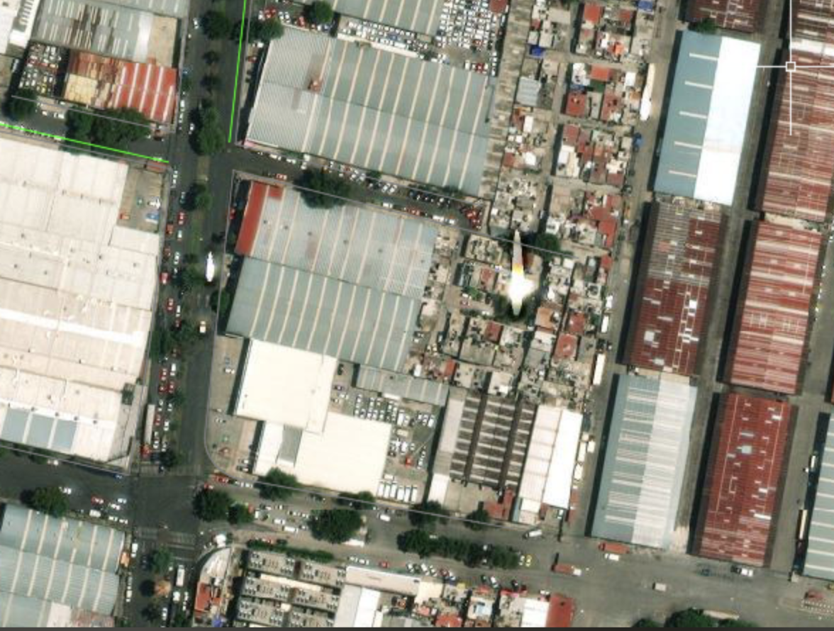
This rainbow-colored airplane isn’t a glitch—and it’s not multiple planes close together. It’s one fast-moving aircraft captured mid-flight by a satellite. When satellites like Sentinel-2 collect imagery, they scan the scene in narrow strips and capture each visible band (red, green, and blue) at slightly different times. Because the plane is moving quickly, it appears in a different position in each band. The result is a misaligned, colorful shadow of the plane in the final image.
.png)
Sometimes imagery includes a sudden, bright white or silvery spot—almost like a flash. This is usually specular reflection: sunlight bouncing directly off a smooth surface, like water, solar panels, or wet plastic. When the sun, surface, and satellite are aligned just right, that reflection gets captured as a bright glare in the image. While it might look like a sensor issue or a burned-out pixel, it’s just light reflecting straight back at the satellite.
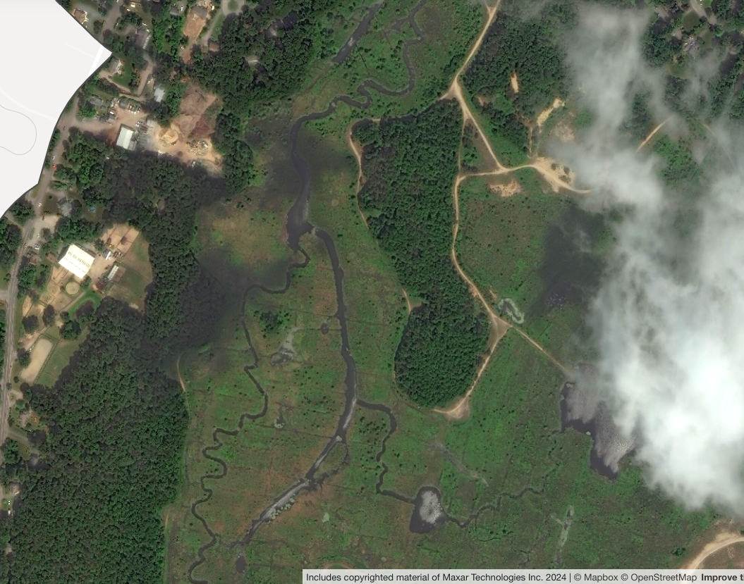
Sometimes you’ll spot dark patches on the ground that don’t line up with anything obvious in the landscape. These are often shadows cast by clouds—or in some cases, by smoke from a nearby wildfire. Depending on the sun angle and the shape of the cloud, you might be able to see both the cloud and its shadow. But sometimes the cloud has moved on or been partially masked, while the shadow is still visible on the ground.
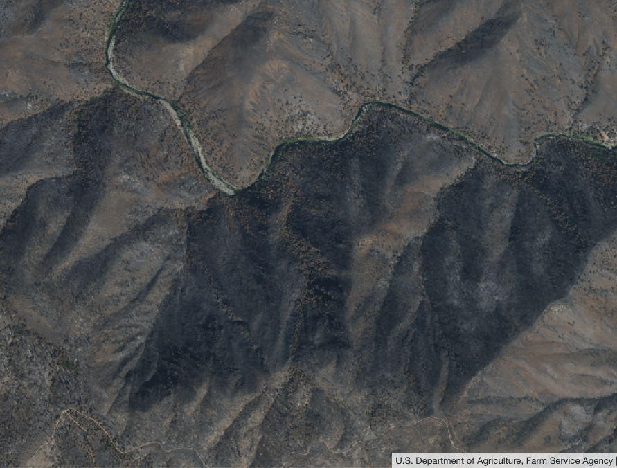
Topography can also cast large shadows—especially in mountainous areas with steep topography. These mountain shadows can look similar to cloud shadows, especially in low-angle light during certain times of the year. In Lens, switching to 3D view can help you quickly tell whether shadows are caused by terrain or something overhead.
Certain surfaces—like solar panels, plastic-covered fields, or smooth rooftops—can strongly reflect near-infrared light. Since water detection algorithms like NDVI use near infrared reflectance to classify surface water, these areas can be misidentified as bodies of water.
In composite imagery, multiple satellite scenes are stitched together to provide more complete or cloud-free coverage. But sometimes the seams between those images are visible, especially if the lighting or surface conditions change between captures. These lines can appear as faint edges or shifts in color or contrast, and you’ll always see mosaic scenes in Lens denoted with this icon and more info about the capture range.

Sometimes imagery shows bright or unusual colors that don’t seem real. This can happen because of color correction issues, but sometimes the colors are accurate—just surprising. For example, cranberry bogs during harvest season can appear bright red in truecolor satellite imagery, or different types of algae can cause bodies of water to appear bright green, pink, or red.
.png)
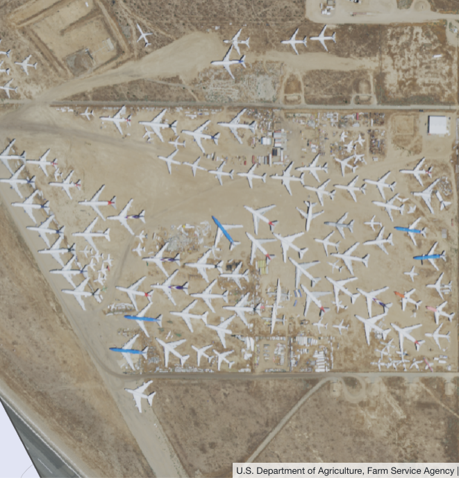
Not all eerie imagery is an artifact—some places just look surprising from above. One example is the Mojave Air and Space Port, sometimes called the Mojave Boneyard. It's where decommissioned commercial aircraft are stored, lined up in long, orderly rows in the California desert.
From satellite imagery, it can look like a strange airplane graveyard—hundreds of jets parked wingtip to wingtip in the sand. It’s not a glitch or an illusion, just a striking reminder of how much aviation hardware ends its service life in the desert.
Hidden in the tidal marshes of Staten Island, this eerie site is home to dozens of abandoned, decaying ships. From above, the rusted hulls scattered in shallow water look like ghostly remnants of a forgotten fleet.

These strange visuals—whether technical quirks or haunting real-world sights—are part of what makes satellite imagery so fascinating. With the right tools and a bit of curiosity, you can uncover the stories behind even the weirdest pixels. Lens makes it easy to dig deeper—compare dates, check cloud masks, and switch datasets to quickly figure out what’s real, what’s an artifact, and what’s just plain strange.
Have you ever found something strange while working with satellite imagery? We'd love to hear more about your work! Get in touch with our team anytime.
.png)

.png)