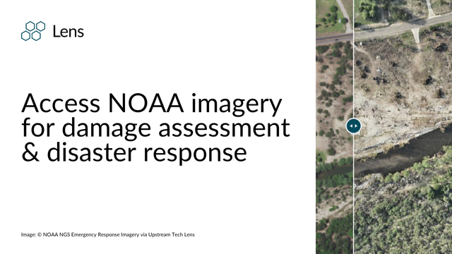
Up-to-date public imagery from natural disasters including 2025 Texas flooding events, LA fires, and Hurricane Helene are available in Lens.
When natural disasters strike, timely and reliable visual information is critical for damage assessment, planning emergency response, and tracking recovery efforts. That’s why the National Oceanic and Atmospheric Administration (NOAA) collects aerial imagery following major events such as hurricanes, wildfires, and floods.
We provide access to NOAA’s open disaster imagery in Lens, making essential information available to users within our platform at no extra cost. NOAA imagery from several 2024-2025 natural disasters is now visible for Lens customers on any plan who have properties that overlap with the captured areas.
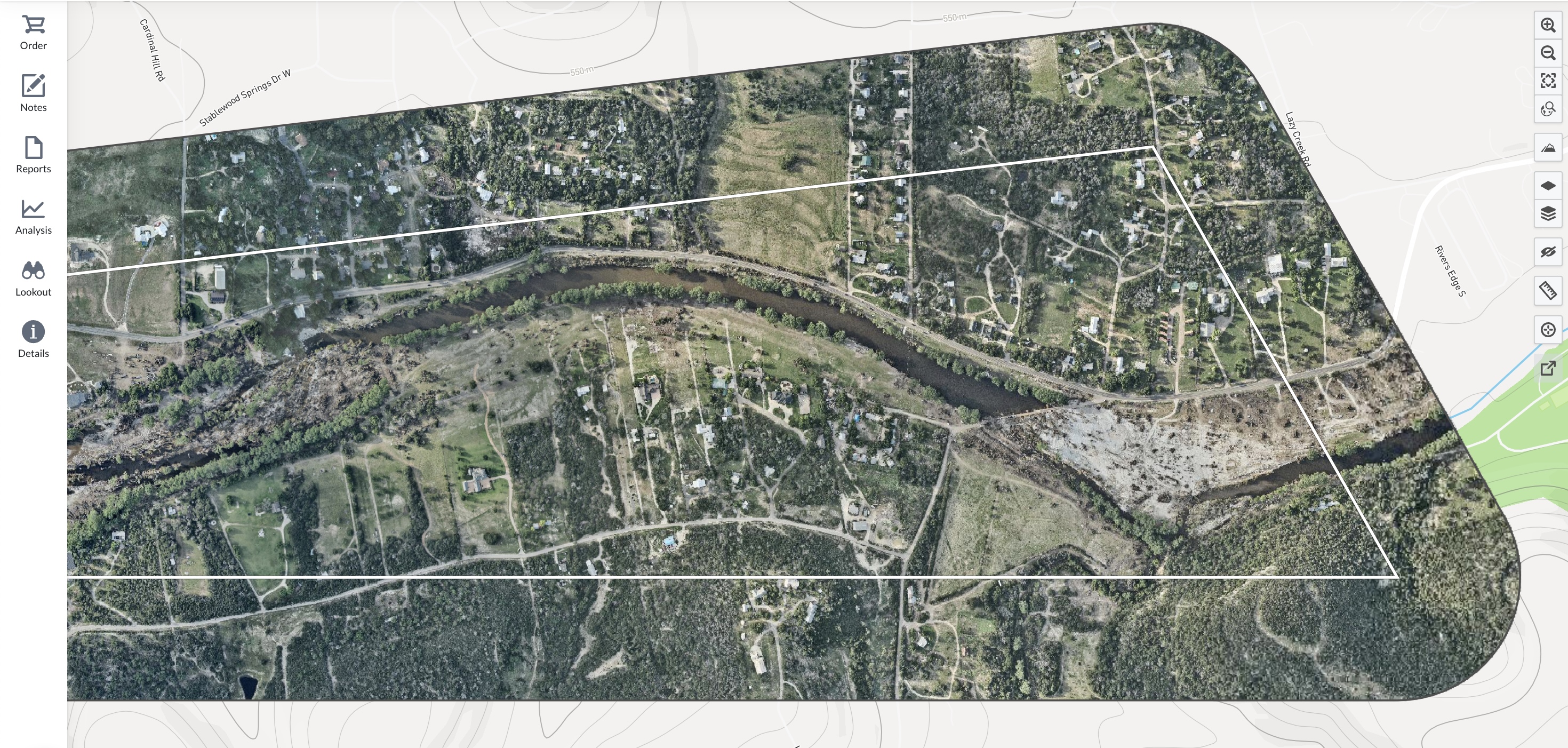
2025 Texas Flooding: NOAA’s flights over Texas during major flooding provides up-to-date visuals, allowing for mapping of inundated neighborhoods and critical infrastructure.
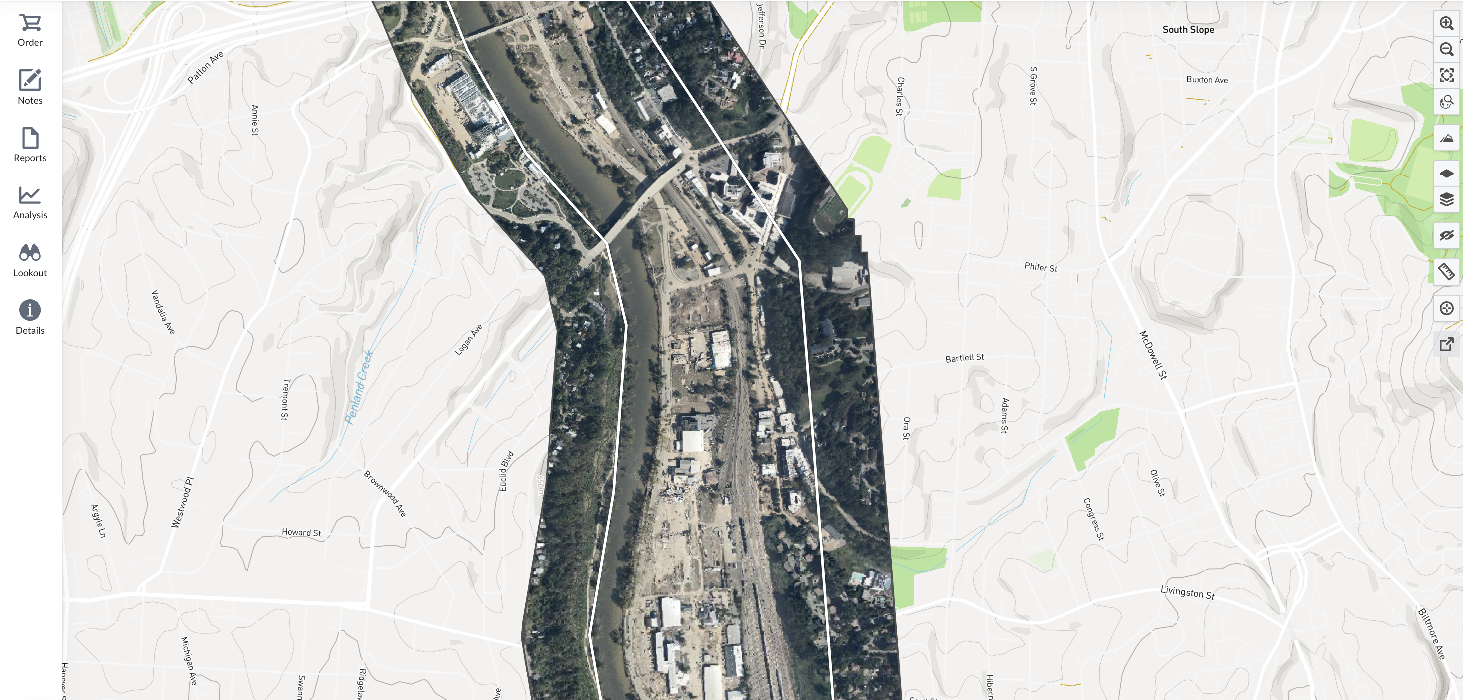
Hurricane Helene: Imagery documented widespread coastal flooding and property damage, aiding officials in prioritizing areas with severe impact.
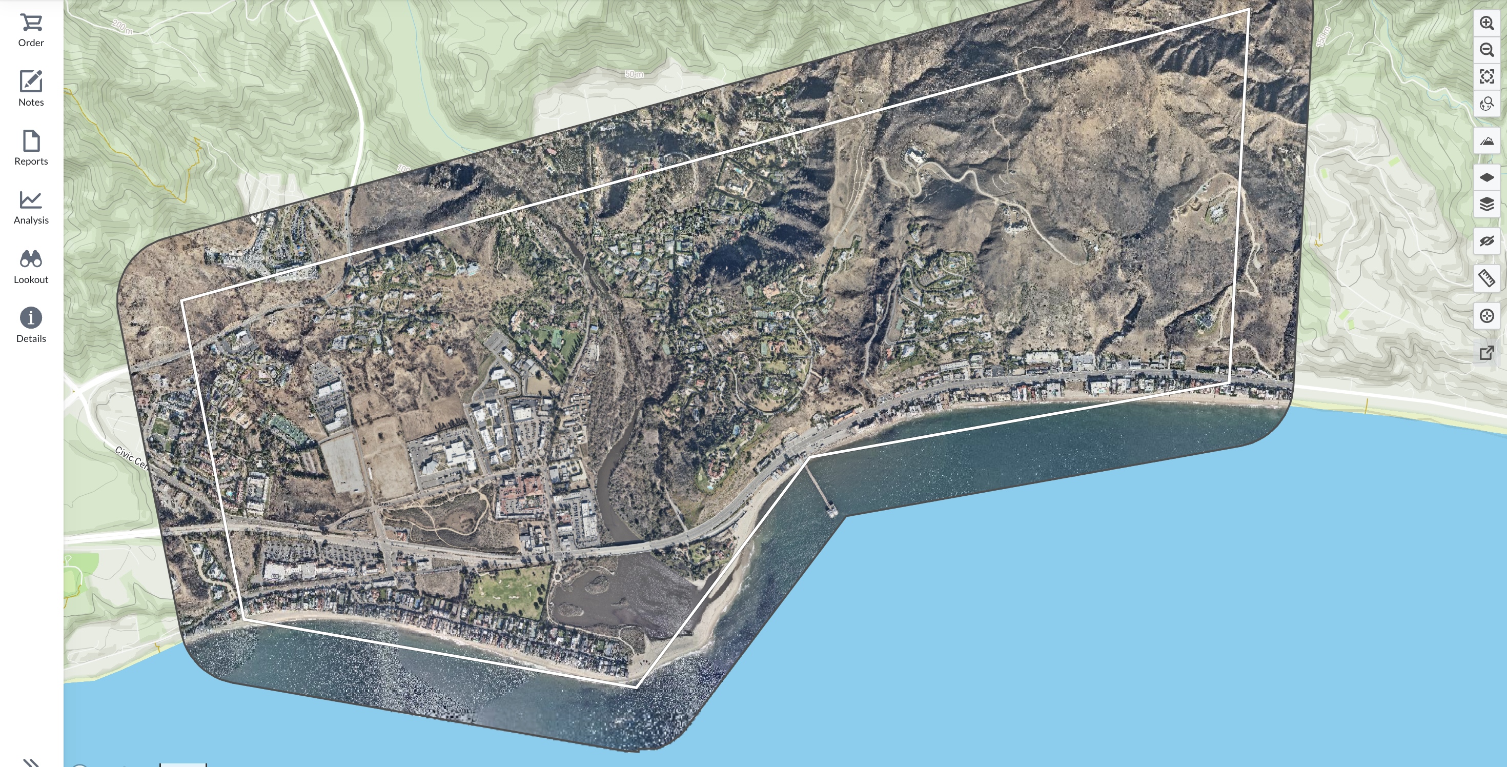
California Wildfires (LA Fires): Post-fire aerial views revealed burn extents, destroyed structures, and changes in the landscape, informing hazard mitigation and rebuilding strategies.
NOAA routinely dispatches airborne teams to collect imagery over disaster-impacted regions. These missions provide an unbiased visual record of the event’s impact, supporting a range of use cases including:
NOAA’s imagery is made available to the public after collection, allowing first responders, government agencies, journalists, and local residents to see for themselves the severity of damage.
Learn more and access data directly from NOAA here.
By bringing NOAA’s open disaster imagery into Lens, we remove technical barriers to make this valuable data easy to use. Users can view affected areas, compare pre- and post-event conditions, and report on disaster impacts such as flooding or fire damage all from Lens. In many cases, this imagery becomes available before it's safe or possible to access sites on the ground, offering a critical early look at conditions.
And this imagery isn’t just useful in the immediate aftermath—it supports continued monitoring as communities rebuild. We hope it helps our users track recovery progress and build toward a more resilient future.
Learn more about Lens plans here or get in touch with our team to get started.